Who we are
We bring extensive expertise spanning oil and gas, mining, municipal, and international projects. Our team is committed to leveraging cutting-edge equipment and technologies, transforming traditionally labor-intensive or dangerous tasks into efficient and safe operations.
Why choose Axis Aerials
By utilizing cutting-edge drone technology in your next project, we help reduce costs, accelerate deliverables, and enhance job site safety. Our modern solutions streamline operations, boost accuracy, and ensure the success of your projects.
Services
Asset Management
Monitor your operations remotely, create impactful presentations, and make informed decisions with 3D models, giving you real-time data about your assets.
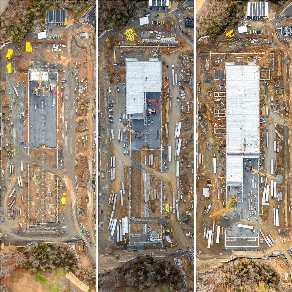
Construction Monitoring
Enhance construction management with aerial monitoring, flexible inspections, pre-construction assessments, and detailed documentation to improve efficiency, safety, and financial dispute prevention.
Mapping & Survey
High accuracy, high precision LiDAR and photogrammetry mapping. With the ability to map up to 200 hectares in a single flight, collecting topograohical data has never been faster or more accurate.
Volumetrics
Faster, more accurate, more cost effective and safer than traditional methods. What used to take days can now be accomplished in hours. From small family-owned gravel pits to large mining operations, stockpiles can now be measured and calculated with same day turn arounds.
Estimating Support
For your next estimate, gain the advantage of a 3D model of the RFP project site. This includes the ability to perform actual site take-offs at any time, apply IFC overlays to the site, review true site conditions, inspect every meter of the site from multiple angles from your desk and ensure evrry detail is acounted for in your pricing.
Drone Pilot for Hire
Our Transport Canada certified, Advanced RPAS pilots are ready to tackle projects of any scale or complexity, delivering customized solutions to meet your organization's unique requirements.